OBX 4X4 BEACH

OBX JEEP RENTAL RATES

Outer Banks Beach Driving
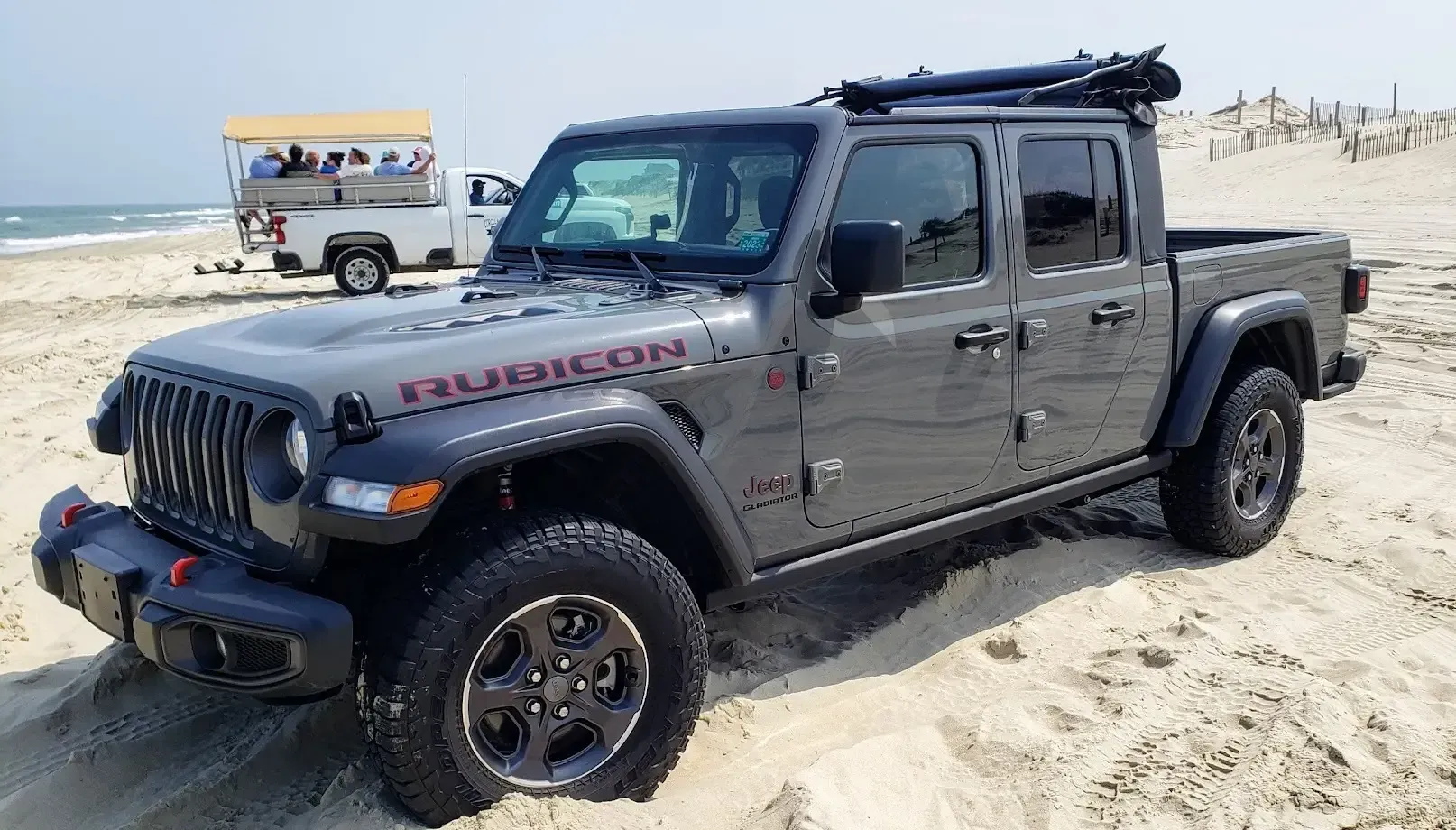
- On the beach, the speed limit is 35 mph.
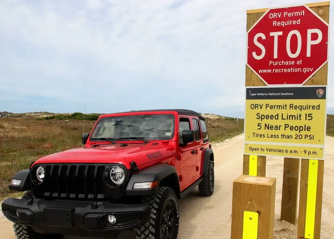
- Driving within 300 feet of any person, the speed limit is 15 mph.
- The entire beach, including parking areas, becomes a driving area after dark. Level all sand structures (sandcastles, holes, etc.) to ensure the safety of those driving on the beach at night.
- Driving in the surf is careless and reckless driving.
- Share the road, and watch for pedestrians, horses, and other wildlife
TIPS
- Gas tanks should be full – there are NO gas stations in 4-wheel drive areas.
- Use 4-wheel drive onto the ramp and maintain a slow, steady speed.
- Low tide is my favorite time to explore the four-wheel-drive-only Outer Banks beaches. Tide chart
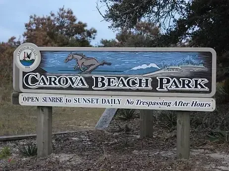
The use of off-road vehicles (ORVs) is a long-standing way for visitors to enjoy the Seashore’s ocean beaches and sound-side waters. To provide for both 4×4 enjoyment and the protection of park resources, please observe the following regulations and recommendations when using ORVs at the Seashore. For more information, please visit National Park Service. Beach driving is allowed year-round on Carova Beach (home to the wild horses) & Hatteras Island.
October 1-April 30 in Nags Head and Kill Devil Hills.
Hatteras & Ocracoke 4×4 Beach
An Off-road vehicle use permit (ORV permit) is required by The National Park Service and is included in your Beach4x4 Jeep rental.
PARTIAL LIST OF OBX AIR-UP STATIONS
Driving on the beach is the one place where if you get it wrong, it can go very badly. So why do we do it? Because it’s fun, it takes you to awesome places, and there’s nothing quite like the feeling of cruising up a beach with your windows down and the wind in your hair.
Unless you’re driving on wet sand after the run-out tide, or indeed after heavy rain, sand is soft. So when you plonk a two-tonne four-wheel drive on it, it has the tendency to want to sink. We stop that sinking or bogging sensation by lowering the tire pressure. This increases the length of the tread pattern on your tire, dispersing its weight over a larger area.
The accepted normal tire pressure on the sand is 18 to 20psi. However, this can be altered by around 20% depending on how heavily (or lightly) your vehicle is laden. As with all rules, though, it’s made to be broken.
If you are badly bogged – or you have found some incredibly soft powdery sand – lower your tire pressure until you get traction. I’d go as low as 8psi. It’s important to note that whenever you lower your tire pressure, your 4X4’s handling ability will be adversely affected. Hence, any cornering needs to be done with absolute caution, not only to keep your vehicle upright but to keep your tires on their rims.
Tires can pop off their rims while pressure is low from sand-spraying yeehaw’s
And when the ground gets firm again, don’t forget to reinflate your tires immediately. Low pressures and high speeds are dangerous concoctions and can lead to tire blowouts and vehicle rollovers.
TECHNIQUE
While correct tire pressures are great, they’re not a cure-all for sand. For that, you need a good driving technique. Sand naturally saps the power of your vehicle, and without power, you can lose momentum and get bogged. So, the key is to keep your momentum up and stop only when it’s safe to do so. It’s good practice to park on downhill slopes to give your 4X4 less of a chance of bogging.
BEACHES
Many beaches can get busy over the summer months, and with no lane markers, it can get a little tricky. This is especially the case at high tide when some beaches get incredibly skinny. Whenever oncoming traffic approaches, always indicate which side of the vehicle you wish to pass on.
Some of the beaches you will drive on will seem perfectly flat and devoid of people, so the temptation is to drive at highway speeds. Yet these speeds don’t take into account the fact that you are not driving in a man-made environment. There may be fresh creeks cut across the sand, driftwood, or an unexpected jump-up, which could cause you all sorts of problems. So, stick to the speed limit, and if there isn’t one, drive at a speed that allows you to stop in a hurry.
The other problem with high speeds and beaches is when people are enjoying some time on the beach. Kids, for example, will naturally run straight from the water up to their beach towels without even looking, and if you’re speeding along the beach, there is no way you can stop in time.
On some beaches, the outgoing waves create dips in the sand, and often you’ll find people sunbaking here. Although very rare, at times these sunbathers have actually been run over by 4X4s that couldn’t see them in the dips until it was too late.
THE BASICS
Minimize sharp turns
Stay off vegetated areas
Be gentle on your brakes
Don’t turn on dunes
Pause at the top of sand dunes
Keep speeds down, but maintain momentum in soft sand
Drive above the high-tide mark, except during a run-out tide
Use your indicators to show your intentions to oncoming vehicles
Re-inflate your tires before getting back to highway speeds.
MISTAKES YOU SHOULDN’T MAKE
Parking your 4X4 under the high-tide mark. You go to take off, but get bogged. Up comes the tide, and the OBX claims another fool.
Guessing tire pressures – I’ve never met anyone who can accurately estimate tire pressure by eye.
Not bringing a tow rope, tire gauge, and a shovel.
Tow Straps are a must for OBX beach driving
Stuck below the high tide line about to get taken by the Atlantic Ocean. Nobody with half a heart is going to leave him there. Unless that is, he doesn’t have a suitable recovery point for a tow rope and you value your life … in that case, the kindest thing to do is grab a shovel and help him dig.
Tow straps/snatch straps work by the use of kinetic energy – think of it like stretching a rubber band and then letting go of one end, in essence, a slingshot effect – and can stretch under load by around 3 feet or so. This may not sound like much, but the energy stored is enough to recover most vehicles out of bogging situations.
Their stretching properties can be dangerous when not used in the correct manner, and it is also, for this reason, they should NEVER be connected to a non-rated recovery point and especially never a tow ball. The power in a rebounding snatch strap can tear off a tow ball and launch it at high speed … and right in through the windshield like a missile. People have been killed or seriously injured this way.
Before you do any recovery with a snatch strap, ensure both vehicles have rated recovery points. If one vehicle doesn’t then you are safer trying to dig it out, road-build, it’s not worth the danger of shackles whizzing through the air.
Prior to reaching for the strap, conduct a visual inspection of the bogging. Look at what is stopping the vehicle (it will be either traction or ground clearance). If ground clearance is the issue (i.e. the vehicle is ‘bottoming out’), grab a long-handled shovel and move away the sand. Likewise, it’s a good idea to clear a track ahead of the wheels to make forward (or rearward) progress easier. All of this preparation ensures that less stress will be placed on the recovery points and on the snatch strap, making for a far safer recovery.
Unroll the snatch strap between the two vehicles to ensure there is enough length. If it’s too short, reverse the recovery vehicle back closer. You are looking at 6-9 feet of slack with the vehicles as in line as possible. Do a final check to ensure there are no twists in the snatch strap.
Attach the strap to the two vehicles by using a rated bow shackle through the eyelets at either end. The bow of the shackle should be against the recovery point, with the strap eyelet lying against the pin.
All bystanders should be well out of the way.
Ensure that both vehicles involved in the recovery are able to communicate – timing is crucial in this type of recovery.
If a third person is able to coordinate, have them also in radio contact but standing well out of the way and off to the side.
The recovery vehicle drives slowly forward until the second vehicle can advise that all the slack has been taken up in the strap. Do NOT step over a snatch strap that is under tension.
Before any recovery is done, both drivers need to ensure – and this goes without saying – that they are both wearing their seatbelts. The force of the rebound can throw an unsuspecting driver into the steering wheel if they aren’t strapped in.
The stuck vehicle should be in first gear low range (in idle) and ready to drive out.
The recovery vehicle will move forward in low-range second gear at the ‘all ready, go’ signal of the driver in the bogged vehicle, via radio or hand signal. Excessive speed is dangerous, go as slow as you can but fast enough to give the snatch strap a chance to rebound.
The driver of the stuck vehicle should drive forward when they feel the jerk of the snatch strap pulling them. The vehicle will literally ‘pop’ out of the bogging.
Once the vehicle is free and able to drive forward, both vehicles can stop and be disconnected from the snatch strap.
If the vehicle does not come out after the first attempt, do not simply attempt another recovery at a higher speed. Instead, re-evaluate the stuck vehicle, and attempt to remove the obstacles that may be in its way. Also, consider lowering tire pressures on the stuck vehicle to give it more traction. Faster recoveries merely increase the ‘shock load’ on the recovery points. It’s this momentary spike in the load that causes the most damage.

onX Maps off-road app Using onX Maps to Find Beach Trails Along the Outer Banks
If you are planning a trip to the Outer Banks and want to explore the many beautiful beaches in the area, you should consider using onX Maps to help you find the best beach trails. onX Maps is a mobile app that offers detailed mapping, location tracking, and navigation features, making it easy to find and explore the many beach trails along the Outer Banks. In this article, we’ll provide a comprehensive guide to using onX Maps to find beach trails along the Outer Banks, including how to download the app, how to use it to find beach trails, and some of the best trails to explore.
Table of Contents
- Introduction
- What is onX Maps?
- Why Use onX Maps to Find Beach Trails?
- How to Download and Use onX Maps
- Finding Beach Trails Using onX Maps
- Best Beach Trails Along the Outer Banks
- Tips for Exploring Beach Trails on the Outer Banks
- Conclusion
- FAQs
Introduction
The Outer Banks is a popular destination for beach-goers, hikers, and outdoor enthusiasts, with miles of beautiful beaches and scenic trails. However, finding the best beach trails can be a challenge, especially if you are not familiar with the area. That’s where onX Maps comes in. With onX Maps, you can easily find and explore the many beach trails along the Outer Banks, from the northern beaches of Corolla to the southern beaches of Ocracoke.
What is onX Maps?
onX Maps is a mobile app that offers detailed mapping, location tracking, and navigation features for outdoor enthusiasts. The app features topographic and satellite maps, as well as public and private land boundaries, allowing users to easily navigate their surroundings and explore new areas. The app also includes features like offline maps, waypoint marking, and geotagging, making it a versatile tool for hikers, hunters, anglers, and anyone else who loves spending time in the great outdoors.
Why Use onX Maps to Find Beach Trails?
Using onX Maps to find beach trails along the Outer Banks offers several advantages over traditional maps and guidebooks. For one, onX Maps provides up-to-date information on trail conditions, closures, and other important details, so you can plan your hike or beach walk accordingly. Additionally, the app offers real-time location tracking, so you can stay on course and avoid getting lost. Finally, onX Maps allows you to customize your mapping experience, with features like waypoint marking and offline maps, giving you more control over your beach trail exploration.
How to Download and Use onX Maps
To start using onX Maps to find beach trails along the Outer Banks, you’ll need to download the app and create an account. The app is available for both iOS and Android devices and can be downloaded from the App Store or Google Play Store. Once you’ve downloaded the app, create an account and sign in to start exploring.
Finding Beach Trails Using onX Maps
To find beach trails using onX Maps, start by zooming in on the area you want to explore. You can use the search function to look for specific beaches or trails, or you can simply browse the map to see what’s available. The app will display trailheads, parking areas, and other points of interest, making it easy to plan your route.

